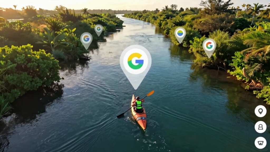
Quick Answer: Google Maps lets kayak anglers scout productive fishing spots by using satellite view to identify structure, vegetation, access points, and water features before launching. The platform’s measurement tools, saved locations, and Street View help you plan safe routes, estimate paddling distances, and verify launch conditions—all from your phone or computer.
Key Takeaways
- Satellite view reveals underwater structure, grass beds, drop-offs, and current breaks that hold fish
- Measure paddling distances from launch points to fishing spots to plan realistic trips based on your fitness level
- Save and organize multiple spots using Google Maps lists to build a personal fishing spot database
- Street View shows real launch conditions including parking, ramp quality, and shoreline access before you arrive
- Google Maps lacks depth data and tide information—pair it with specialized fishing apps for complete trip planning
- Terrain view highlights elevation changes that indicate channels, points, and structure in rivers and lakes
- Common mistakes include ignoring private property boundaries and overestimating paddling ability based on straight-line distances
- Google Earth provides better detail with historical imagery and 3D terrain for advanced scouting
What Features in Google Maps Help Find Kayak Fishing Spots
Google Maps offers several tools specifically useful for kayak fishing reconnaissance. The satellite view shows real-time imagery of water bodies, revealing vegetation patterns, structure, and color variations that indicate depth changes. The measurement tool calculates exact distances between launch points and fishing areas, while the terrain layer displays elevation data that helps identify channels and drop-offs.
Key features for scouting:
- Satellite imagery – Shows water color, vegetation, structure, and shoreline features
- Measurement tool – Calculates paddling distances and helps plan routes
- Terrain view – Reveals elevation changes indicating underwater structure
- Street View – Provides ground-level photos of launch sites and access points
- Saved locations – Organizes multiple fishing spots into custom lists
- Directions – Estimates drive time to launch points and suggests parking areas
The search function helps locate nearby boat ramps, public access points, and fishing piers. Type “boat ramp near [location]” or “kayak launch” to find official access sites. Many ramps appear with user photos showing actual conditions, parking availability, and facility quality.
Choose Google Maps for initial reconnaissance if you need free, accessible scouting tools with good satellite coverage and you’re fishing popular public waters. Skip it as your only tool if you need precise depth data, real-time weather, or detailed private lake information.
How to Identify Shallow Water Areas on Google Maps for Kayaking
Shallow water appears lighter in color on satellite imagery compared to deeper sections. In clear water, you’ll see tan, light green, or turquoise tones indicating shallow flats, while darker blue or green shows deeper channels and holes. Vegetation visible through the water surface—grass beds, lily pads, or submerged structure—confirms shallow areas ideal for shallow water fishing from a kayak.
Visual indicators of shallow water:
- Light-colored water (tan, pale green, turquoise) versus dark blue or black
- Visible bottom features including sand, rocks, or vegetation
- Grass beds and lily pads showing through the surface
- Sandbars and points extending from shorelines
- Color transitions marking depth changes and drop-offs
Switch between satellite view and terrain view to cross-reference. Terrain mode shows elevation data that confirms shallow flats and identifies channels cutting through them. Look for narrow strips of darker water cutting through lighter areas—these channels often hold fish moving between shallow feeding areas and deeper water.
Common mistake: Assuming all light-colored water is shallow enough for kayaking. In murky or stained water, color doesn’t reliably indicate depth. Sediment, algae, and tannins can make deep water appear light brown or green. Always verify depth with local knowledge, fishing apps with bathymetric data, or a portable depth finder before committing to a long paddle.
For river kayak fishing, look for inside bends where current slows and sediment deposits create shallow flats. Outside bends typically show darker water indicating deeper channels carved by faster current.
Google Maps vs OnX Maps for Scouting Fishing Locations
Google Maps provides free, general-purpose satellite imagery and basic navigation tools suitable for scouting public waters and identifying obvious structure. OnX Maps (specifically the Offroad or Hunt versions adapted for fishing) offers property boundaries, land ownership data, public access overlays, and offline map downloads—critical for determining where you can legally launch and fish.
Comparison for kayak fishing:
| Feature | Google Maps | OnX Maps |
|---|---|---|
| Cost | Free | $30-100/year subscription |
| Property boundaries | Not shown | Detailed parcel data |
| Public access markers | Limited | Comprehensive |
| Offline maps | Limited download | Full offline capability |
| Satellite detail | Good, frequently updated | Good, less frequent updates |
| Depth data | None | None (both lack bathymetry) |
| Ease of use | Excellent | Moderate learning curve |
Choose Google Maps if you’re fishing well-known public waters with obvious access points, you want quick free reconnaissance, and you don’t need property boundary information. It excels for urban fishing spots, state parks, and popular lakes with established launch sites.
Choose OnX Maps if you’re exploring new areas where property boundaries matter, you need to verify public access rights, or you’ll be paddling in areas with limited cell service requiring offline maps. The property ownership layer prevents trespassing issues that can arise when launching from unmarked shorelines.
For complete trip planning, many kayak anglers use both: Google Maps for initial scouting and structure identification, then OnX Maps to verify access legality and download offline maps before the trip. Neither platform provides water depth data—pair them with Navionics, Fishbrain, or similar fishing apps for bathymetric charts.

Features some of the top fishing locations in Florida including Port Rickey, Tarpon Springs, Clearwater Sarasota Bay and Venice


Can You See Boat Ramps and Kayak Launch Points on Google Maps
Yes, Google Maps shows many boat ramps and kayak launch points when you search for them directly or zoom in on waterfront areas. Type “boat ramp” or “kayak launch” in the search bar, and the map displays nearby facilities with user ratings, photos, and reviews. Public ramps typically appear as marked locations with names like “[Lake Name] Boat Ramp” or “[Park Name] Kayak Launch.”
How to find launch points:
- Search “boat ramp near me” or “kayak launch [lake name]”
- Zoom in on waterfront areas and look for parking lots adjacent to water
- Check Street View to see actual ramp conditions and parking availability
- Read user reviews for details about fees, hours, and kayak-friendliness
- Look for park or recreation area markers along shorelines
Not all launches appear in search results. Many informal access points, fishing piers, and small public beaches suitable for kayak launching don’t have official markers. Zoom in and scan shorelines for parking areas, road ends, and cleared areas meeting the water—these often indicate usable access even without labels.
Street View verification: Before driving to a launch site, use Street View to check pavement quality, parking space availability, and whether the ramp accommodates kayaks or only larger boats. Some “boat ramps” have steep concrete ramps designed for trailers that are awkward for hand-launching kayaks. Look for gentler slopes, sandy beaches, or designated kayak launch areas in the photos.
For beginner kayak fishing trips, prioritize launches with good parking, gentle slopes, and protected water. User photos often show these details better than satellite view alone.

Made to fit NuCanoe Unlimited - Bow. Check your model and dry-fit the guard before installation.

Sunrise Is My Boat Ramp shows a kayak resting on shore beneath a rising sun and mist bands, perfect for the kayak angler who chases bass from a paddle or pedal kayak.

Made to fit Wilderness Systems ATAK 120 - Bow. Check your model and dry-fit the guard before installation.
How to Measure Distance from Shore to Fishing Spot in Google Maps
Right-click anywhere on the map and select “Measure distance” to calculate the exact paddling distance from your launch point to a fishing spot. Click additional points along your intended route to account for obstacles, shoreline contours, and safe navigation paths. The tool displays total distance in feet, yards, or miles at the bottom of the screen.
Step-by-step distance measurement:
- Find your launch point on the map (boat ramp, beach, or access site)
- Right-click on the launch location and select “Measure distance”
- Click each point along your intended paddling route
- Click on your target fishing spot to complete the measurement
- Note the total distance displayed at the bottom of the screen
Planning realistic trips: A comfortable paddling pace in a fishing kayak averages 2-3 miles per hour in calm conditions. A spot showing 2 miles from the launch requires 40-60 minutes of paddling one way, plus return time and fishing time. Factor in wind, current, and your fitness level—beginners should start with spots under 1 mile from launch.
Common mistake: Measuring straight-line distance instead of actual paddling routes. Always click waypoints around islands, through channels, and along safe navigation paths. A spot appearing 1 mile away in a straight line might require 1.5 miles of actual paddling to navigate safely around shallow areas or private property.
For ocean kayak fishing, add significant buffer distance for wind and current. A 2-mile paddle in protected water becomes much more challenging in open ocean with wind and waves. Measure distances conservatively and always plan for conditions to worsen during your trip.
What to Look for on Satellite View to Find Good Kayak Fishing Areas
Productive kayak fishing spots show visible structure, vegetation transitions, and water color changes on satellite imagery. Look for points extending into the water, creek mouths, grass bed edges, docks, and submerged structure creating shadows or color variations. These features concentrate baitfish and provide ambush points for predator fish.
High-value features visible on satellite view:
- Points and peninsulas – Shoreline extensions creating current breaks and ambush spots
- Creek and river mouths – Darker water indicating channels bringing food and oxygen
- Grass bed edges – Transition zones between vegetation and open water
- Docks and piers – Structure providing shade and cover
- Color changes – Depth transitions, current seams, and bottom composition shifts
- Islands and humps – Isolated structure surrounded by deeper water
- Fallen trees and logs – Visible shoreline structure extending into water
- Boat channels – Dredged cuts through shallow flats
Zoom in close and look for shadows in the water indicating submerged structure, rocks, or vegetation. In clear water, you can often see individual boulders, stumps, and grass clumps that hold fish. Darker patches within lighter shallow areas often indicate holes or depressions where fish stage.
Seasonal considerations: Satellite imagery captures conditions on a specific date, often during summer. Vegetation that appears thick in summer imagery may be sparse in spring or fall. Water levels change seasonally—a shallow flat in summer might be dry land in drought conditions or deep water during spring floods.
For bass fishing, prioritize areas with multiple structure types close together: a point with grass beds, adjacent to deeper water, near a dock or fallen tree. These “spot-on-a-spot” locations concentrate fish and give you multiple presentation options from your kayak.
Is Google Maps Accurate Enough for Kayak Fishing Trip Planning
Google Maps provides sufficient accuracy for identifying structure, planning routes, and locating access points, but it lacks critical safety information including water depth, current speed, tide data, and real-time weather. Use it as a primary reconnaissance tool for finding spots and measuring distances, then supplement with specialized fishing and marine weather apps for complete trip planning.
What Google Maps does well:
- Accurate satellite imagery showing structure and features
- Reliable distance measurements for trip planning
- Current access point locations and conditions (via user photos)
- General navigation and driving directions to launch sites
What Google Maps lacks:
- Water depth data – No bathymetric charts or depth contours
- Tide and current information – Critical for coastal and tidal river fishing
- Real-time weather – Wind speed, wave height, and forecast data
- Water temperature – Important for fish activity and seasonal patterns
- Fishing regulations – Boundaries, seasons, and special rules
Recommended supplemental apps: Pair Google Maps with Navionics (for depth charts), Windy or NOAA Weather (for marine forecasts), and Fishbrain or local fishing apps (for regulations and recent catch reports). This combination provides complete trip planning information for safe, productive kayak fishing.
For kayak safety, never rely solely on Google Maps. Check marine weather forecasts, understand local tidal patterns, and verify water conditions before launching. A spot that looks perfect on satellite imagery might be dangerous in strong current, high wind, or heavy boat traffic.
How to Save and Organize Multiple Fishing Spots in Google Maps
Click “Save” on any location to add it to your saved places, then organize spots into custom lists for different water bodies, fish species, or seasonal patterns. Create lists like “Spring Bass Spots,” “Saltwater Kayak Launches,” or “[Lake Name] Structure” to build a personal fishing spot database accessible from any device.
Creating organized fishing spot lists:
- Search for or click on a fishing spot you want to save
- Click the “Save” button in the location details panel
- Select an existing list or click “New list” to create a custom category
- Name your list descriptively (e.g., “Lake Murray Bass Points”)
- Add notes in the location description field (structure type, best tide, etc.)
- Repeat for additional spots, organizing by water body or species
Naming conventions that work: Use consistent naming that includes water body, structure type, and any seasonal notes. Examples: “Smith Lake – North Point – Spring,” “Harbor Channel – Grass Edge – High Tide,” or “River Bend – Fallen Tree – Summer.” This system helps you quickly identify spots when planning trips.
Adding custom notes: Click on any saved location, then click “Add a note” to record details invisible on the map: best tide stage, productive lures, fish species caught, parking fees, or hazards to avoid. These notes sync across devices and build institutional knowledge over time.
Sharing lists: Make lists public to share with fishing partners or keep them private for personal use. Public lists appear in search results and can help other kayak anglers find access points, while private lists protect your hard-earned fishing spots.
Access your saved lists from the menu (three horizontal lines) > “Your places” > “Saved.” All lists appear here and sync automatically across your phone, tablet, and computer when signed into your Google account.
Common Mistakes When Using Google Maps to Find Kayak Fishing Locations
The most frequent error is ignoring property boundaries and assuming all shoreline is public access. Google Maps doesn’t show property lines, leading anglers to plan launches from private land or fish in restricted areas. Always verify access legality using OnX Maps, state wildlife agency resources, or local knowledge before launching from unmarked locations.
Critical mistakes to avoid:
- Assuming all water is public – Many lakes have private shorelines with limited public access
- Measuring straight-line distances – Actual paddling routes are longer due to obstacles and safe navigation
- Ignoring wind and current – A calm-looking spot on satellite view might be dangerous in real conditions
- Trusting outdated imagery – Satellite photos may be months or years old; conditions change
- Overlooking parking restrictions – Street View shows current conditions, but rules change seasonally
- Planning trips beyond your ability – Beginners often overestimate paddling stamina based on map distances
- Skipping weather verification – Google Maps shows no weather data; always check marine forecasts
Outdated imagery issues: Satellite photos capture conditions on a specific date, sometimes years ago. New development, changed water levels, removed vegetation, or altered access points won’t appear in older imagery. Check the image date in the bottom-right corner of satellite view and verify current conditions with recent user photos or local reports.
Private property problems: Lakefront homes, resorts, and private communities often own shoreline that appears accessible on satellite view. Launching from or fishing near private docks, beaches, or marked areas can result in trespassing citations. When in doubt, use only marked public access points and stay in clearly public waters.
For fishing kayak safety gear planning, don’t assume a short paddle means low risk. Even spots close to launch can be dangerous in wind, current, or cold water. Always wear a PFD, carry communication devices, and tell someone your float plan regardless of distance.
Does Google Maps Show Water Depth for Kayak Fishing
No, Google Maps does not display water depth, bathymetric contours, or underwater topography. The platform shows surface features visible in satellite imagery but provides no subsurface depth information critical for understanding fish habitat and navigation safety. Kayak anglers need specialized marine navigation apps like Navionics, C-MAP, or Fishbrain for depth charts.
Why depth matters for kayak fishing:
- Safety – Avoiding shallow rocks, sandbars, and grounding hazards
- Fish location – Understanding depth transitions where fish concentrate
- Structure identification – Finding humps, holes, and channels invisible from surface
- Seasonal patterns – Tracking fish movement between shallow and deep water
Apps that provide depth data:
- Navionics – Comprehensive bathymetric charts for coastal and inland waters ($15-50/year)
- C-MAP – Detailed depth contours and fishing-specific features (subscription-based)
- Fishbrain – Community-sourced depth data and catch reports (free and premium tiers)
- Deeper – Pairs with portable sonar units to create custom depth maps
- Local lake maps – Many state wildlife agencies publish free bathymetric charts
Use Google Maps to identify surface structure and access points, then overlay that information with depth charts from specialized apps. This combination reveals complete fishing spot potential: visible structure on satellite view plus underwater contours showing depth transitions and hidden features.
For beginner kayak fishing in unfamiliar water, depth information prevents dangerous situations. Shallow rocks, sudden drop-offs, and submerged obstacles invisible on Google Maps can damage your kayak or create safety hazards. Always consult depth charts before exploring new areas.
How to Tell If a Spot Is Safe for Kayak Fishing Using Google Maps
Evaluate safety by examining satellite view for protected water, nearby hazards, and escape routes. Look for spots sheltered from prevailing winds by land masses, with multiple exit routes, away from heavy boat traffic channels, and close enough to shore for emergency swimming if needed. Street View and user photos reveal additional safety factors including parking security and launch conditions.
Safety checklist using Google Maps:
- Wind protection – Land masses blocking prevailing wind directions
- Proximity to shore – Stay within safe swimming distance for your skill level
- Boat traffic – Avoid main channels, busy marinas, and high-speed zones
- Multiple exits – Alternative routes back to launch if conditions worsen
- Emergency access – Nearby boat ramps or beaches for emergency extraction
- Cell coverage – Urban and developed areas typically have better signal
- Parking visibility – Well-lit, visible parking areas reduce vehicle break-in risk
Red flags indicating unsafe conditions:
- Open water with no wind protection from islands or shoreline
- Narrow channels with strong current visible in satellite imagery (color differences)
- Areas marked with navigation hazards, restricted zones, or warning symbols
- Locations far from any emergency access or help
- Heavy commercial shipping lanes or ferry routes
Measure distance from your fishing spot to the nearest safe shore—not just back to your launch point. In an emergency (capsize, injury, sudden weather), you need the closest safe landing, which might be a different beach or shoreline than where you launched.
Current and tide indicators: In tidal areas, look for current patterns visible in satellite imagery—ripples, color changes, or disturbed water around points and bridges. Strong current creates dangerous conditions for kayak fishing. Check tide charts and current predictions (not available in Google Maps) before fishing any tidal water.
For comprehensive kayak safety tips, always file a float plan with someone on shore, carry communication devices, wear appropriate clothing for water temperature, and check marine weather forecasts before every trip. Google Maps helps identify safer locations, but it can’t predict weather changes or your physical condition.
Best Apps to Use Alongside Google Maps for Kayak Fishing
Combine Google Maps with specialized fishing, weather, and navigation apps for complete trip planning. Use Google Maps for initial reconnaissance and structure identification, Navionics or C-MAP for depth charts, Windy or NOAA Weather for marine forecasts, and Fishbrain or local fishing apps for regulations and recent catch reports.
Essential companion apps:
Navigation and depth:
- Navionics – Industry-standard bathymetric charts, depth contours, and navigation features
- C-MAP – Detailed marine charts with fishing-specific overlays
- OnX Offroad/Hunt – Property boundaries and public access verification
Weather and conditions:
- Windy – Detailed wind forecasts with multiple weather models
- NOAA Weather – Official marine forecasts, tide predictions, and warnings
- Tides Near Me – Tide charts and current predictions for coastal fishing
Fishing intelligence:
- Fishbrain – Social fishing app with catch reports, spot recommendations, and community knowledge
- FishAngler – Catch logging, local reports, and tournament features
- State wildlife apps – Regulations, license verification, and species identification
Workflow for complete trip planning:
- Scout with Google Maps – Identify structure, access points, and measure distances
- Verify access with OnX – Confirm public access rights and property boundaries
- Check depth with Navionics – Understand underwater structure and safe navigation routes
- Review weather with Windy – Verify safe conditions for your planned trip date
- Research with Fishbrain – Read recent catch reports and local knowledge
This multi-app approach provides comprehensive information Google Maps alone cannot deliver. Each app serves a specific purpose, and together they create a complete picture of fishing potential, access legality, and safety conditions.
For those learning how to read a fish finder screen, many of these apps help interpret depth data and structure before you invest in dedicated sonar equipment for your kayak.

READY TO GO - Easily find where your next catch is hiding with the Deeper START Fish Finder! The lightweight and sleek design makes for a seamless reel without any messy wires or fiddly external batteries required. Ideal for shore anglers and family trips who want to get on with catching!

Clear Vu scanning Sonar shows you more of what is in the water around your boat; This high frequency sonar gives near photographic images with detailed representations of objects, structure and fish

✦ Fish Finder and Depth Finder : It is a portable fish finder that could display approximate fish location and water depth. The sonar transducer can be attached to the hull of kayak or boat in order to understand the changing of water depth when you are moving by. The water depth detection range is between 3ft(1m) and 328ft (100m) when the transducer is completely immersed in the water.
Can Google Maps Show Current and Tide Information for Coastal Kayak Fishing
No, Google Maps does not display tidal predictions, current speed, or tidal stage information. Coastal kayak anglers must use specialized marine weather apps like NOAA Tides & Currents, Tides Near Me, or Windy for this critical safety and fishing information. Tides and currents dramatically affect fish location, paddling difficulty, and safety in coastal and tidal river environments.
Why tide and current data matters:
- Safety – Strong currents make paddling exhausting or impossible
- Fish location – Many species feed actively during specific tidal stages
- Access timing – Some launches become unusable at low tide
- Energy management – Paddling with current versus against it affects trip feasibility
Apps for tide and current information:
- NOAA Tides & Currents – Official predictions from government data (free, highly accurate)
- Tides Near Me – User-friendly interface with multiple station data
- Windy – Includes tide predictions along with wind and weather forecasts
- Navionics – Displays tide stations on marine charts for integrated planning
Planning coastal trips: Check tide predictions for your launch time and expected return. Plan to paddle with outgoing tide to your fishing spot, then return with incoming tide when possible. This strategy conserves energy and provides safety margin if you’re delayed. Avoid fishing during peak current flow (mid-tide) when water movement is strongest—fish and paddle during slack tide periods for easier conditions.
Current indicators on Google Maps: While Google Maps doesn’t show current data, you can sometimes see current effects in satellite imagery. Look for ripples, disturbed water, or color changes around points, bridges, and channel constrictions. These visual cues indicate strong current areas to avoid or fish strategically.
For inshore saltwater kayak fishing, understanding tidal current patterns is as important as knowing structure locations. Use Google Maps to find structure, then overlay tide and current data to determine the best times to fish each spot.
How to Use Google Earth Instead of Google Maps for Better Fishing Spot Details
Google Earth provides higher-resolution imagery, 3D terrain visualization, and historical imagery comparison that reveal details invisible in standard Google Maps. Download the free Google Earth Pro desktop application for advanced features including elevation profiles, measurement tools, and the ability to view the same location across multiple years to track seasonal changes and water level variations.
Google Earth advantages for kayak fishing:
- Higher resolution imagery – More detail in structure, vegetation, and bottom features
- 3D terrain view – Visualize underwater contours and depth transitions
- Historical imagery – Compare the same spot across multiple years and seasons
- Elevation profiles – Measure depth changes along your planned route
- Better measurement tools – More precise distance and area calculations
- Offline capability – Cache imagery for use without internet connection
Using historical imagery: Click the clock icon in Google Earth to access imagery from different dates. Compare summer versus winter views to see seasonal vegetation changes, or view multiple years to identify permanent structure versus temporary features. Low-water imagery from drought years often reveals bottom structure invisible during normal water levels.
3D terrain for depth estimation: Tilt the view in Google Earth to see terrain in three dimensions. Underwater slopes, channels, and depth transitions become visible in 3D view, helping you understand structure that appears flat in standard satellite view. This feature works best in clear water where bottom features are visible.
Creating custom maps: Use Google Earth’s placemark and path tools to mark fishing spots, draw paddling routes, and annotate features with detailed notes. Export these custom maps as KML files that open in Google Maps on your phone for on-water navigation.
When to use Google Earth versus Google Maps:
- Use Google Earth for – Detailed pre-trip planning, structure analysis, historical comparison, and creating custom maps
- Use Google Maps for – On-water navigation, finding nearby services, real-time location tracking, and quick mobile access
Most serious kayak anglers use Google Earth for desktop planning sessions, then transfer saved locations to Google Maps for mobile access during trips. This workflow combines the detailed analysis capabilities of Earth with the convenience and real-time features of Maps.
Frequently Asked Questions
Can I use Google Maps offline for kayak fishing trips?
Yes, download map areas in advance by searching for a location, tapping the name/address at the bottom, selecting the menu (three dots), and choosing “Download offline map.” Offline maps include satellite view and saved locations but lack real-time traffic, weather, and some search features. Download areas expire after 30 days and must be updated.
How accurate are the distances measured in Google Maps for paddling?
Distance measurements are accurate to within a few feet for the route you draw, but they show straight-line or point-to-point distances, not actual paddling effort. Wind, current, waves, and navigation around obstacles increase real-world paddling time and energy expenditure beyond what distance alone suggests. Always add 25-50% buffer time for challenging conditions.
Does Google Maps show fishing regulations or license requirements?
No, Google Maps does not display fishing regulations, license requirements, seasonal closures, or catch limits. Check your state wildlife agency website or app for current regulations. Many states offer mobile apps with GPS-enabled regulation lookup showing rules for your exact location.
Can I see water temperature on Google Maps?
No, Google Maps does not show water temperature data. Use fishing apps like Fishbrain, marine weather services like NOAA, or dedicated fishing forecast services for water temperature information. Water temperature significantly affects fish behavior and seasonal patterns.
How often does Google update satellite imagery for fishing areas?
Update frequency varies by location from several times per year in urban areas to every 1-3 years in rural regions. Check the image date in the bottom-right corner of satellite view. Popular fishing destinations typically receive updates more frequently than remote areas.
Will Google Maps work without cell service while kayak fishing?
Only if you download offline maps before losing signal. Without offline maps or cell service, Google Maps cannot load new imagery, search for locations, or update your position. Always download maps and carry backup navigation tools (compass, paper charts) for areas with poor cell coverage.
Can Google Maps help me find kayak fishing spots in new states or regions?
Yes, Google Maps works nationwide and internationally, making it excellent for scouting unfamiliar waters before traveling. Search for boat ramps, read user reviews, examine satellite imagery, and measure distances to plan productive fishing in new locations. Combine with local fishing forums and state wildlife resources for complete information.
Does Google Maps show private versus public water access?
No, Google Maps does not distinguish private from public property or water access rights. Use OnX Maps, state wildlife agency resources, or local knowledge to verify access legality. Assume all unmarked access points are private unless confirmed otherwise.
How do I mark a fishing spot in Google Maps without an address?
Drop a pin by long-pressing (mobile) or right-clicking (desktop) on the exact location. The pin creates a saved location you can name, add to lists, and navigate to later. This works for any spot including mid-water structure, points, and unmarked access areas.
Can I share my saved fishing spots with friends using Google Maps?
Yes, make your saved lists public or share individual locations via link, text, or email. Click any saved location, tap “Share,” and choose your sharing method. Friends can open shared locations in their own Google Maps app for navigation and reference.
What’s the best way to scout kayak fishing spots if Google Maps imagery is outdated?
Check Google Earth for more recent imagery or different seasonal views, search for recent user photos in Google Maps reviews, join local fishing forums or Facebook groups for current reports, or visit in person for direct reconnaissance. State wildlife agencies sometimes publish recent aerial surveys of popular fishing waters.
Does Google Maps show kayak-specific hazards like low bridges or rapids?
No, Google Maps does not mark kayak-specific hazards. Use specialized paddling resources like American Whitewater, state paddling guides, or local kayak shops for hazard information. Always scout unfamiliar water in person or consult experienced local paddlers before launching.
Conclusion
Learning how to use Google Maps to scout kayak fishing spots transforms trip planning from guesswork into strategic reconnaissance. The platform’s satellite imagery reveals structure, vegetation, and water features that hold fish, while measurement tools help you plan realistic paddling distances based on your fitness level and kayak type. Saved locations and custom lists build a personal fishing spot database accessible from any device, and Street View verification prevents wasted trips to unsuitable launch sites.
Take action on your next fishing trip:
- Scout three potential spots using satellite view to identify structure and access points
- Measure paddling distances from launch to fishing areas, adding buffer time for conditions
- Verify access legality using OnX Maps or state resources before launching
- Download offline maps for your fishing area in case cell service is limited
- Supplement with specialized apps for depth charts, weather forecasts, and tide predictions
- Save and organize spots into custom lists for different seasons, species, or water bodies
Google Maps excels as a free, accessible reconnaissance tool, but it’s not a complete solution. Pair it with marine weather apps, depth chart services, and local knowledge for safe, productive kayak fishing. Start with protected waters close to launch, verify current conditions before every trip, and always prioritize safety over fishing success.
The most successful kayak anglers spend as much time studying maps as they do on the water. Whether you’re exploring a new lake, planning a tandem fishing kayak trip with a partner, or searching for productive river kayak fishing spots, Google Maps provides the foundation for informed decisions that put you on fish while keeping you safe. Download the app, start scouting, and turn digital reconnaissance into real-world catches.